|
|
|
|
|---|---|---|
|
Updated April 3, 2024 Lower Walker River Bird Finding Guide and Checklist 2019 Consumer Confidence Report for Drinking Water Proposed Tribal Water Quality Standards Walker River Paiute Tribe-2018 Climate Change Adaptation Plan April 3, 2024
- Walker Lake Delta Monitoring - Annual Status Monitoring for Flows,
Erosions, and Vegetation.
October 5, 2023 - Walker Lake Delta Monitoring - The lake has noticably gained increase as of today (10-5-2023), water still coming into the lake at this time.
June 26, 2023 - Weber Reservoir Monitoring - Fuse Plug Removal, Construction Site Prep.
June 6, 2023 - Weber Reservoir Monitoring - Spillway, Fish Passage, Fuse Plug and Camping Area.
June 6, 2023 - Weber Reservoir and downstream flood monitoring, USGS Streamflow recording at 2,800+ cubic feet per second below the reservoir during this day. May 2023 - Walker Lake Delta, high water year lake monitoring, record year Walker River Watershed snowpack (300%) will have an affect on the drought stricken conditions from previous years at Walker Lake (Agai Pah). March 2023 - Weber Reservoir and downstream flood monitoring, for possible high river water causing erosion and down trees.
August 2022 - Walker Lake and Walker River monoriting during drought conditions. The lake has declined since the previous video in 2017.
Drone Technology being used for mapping the Walker River, maps will be utilized for future nonpoint source projects to address water quality. WHAT IS NONPOINT SOURCE POLLUTION: Nonpoint source generally results from land runoff, precipitation, atmospheric desposition, drainage, seepage or hydraulic modification.The term "nonpoint source" is define to mean any source of water pollution that does not meet the legal definition of "point source" in section 502(14) of the Clean Water Act. That definition states: The term "point source" means any discernible, confined and discrete conveyance, including but limited to any pipe, ditch, channel, tunnel, conduit, well, discrete fissure, container, rolling stock, concentrated animal feeding operation, or vessel or other floating craft, from which pollutants are or may be discharged. This term does not include agricultural storm water discharges and return flows from irrigated agriculture. Unlike pollution from industrial and sewage treatment plants, nonpoint source (NPS) pollution comes from many diffuse sources. NPS pollution is caused by rainfall or snowmelt moving over and through the ground. As the runoff moves, it pickups and carries away natural human-made pollutants, finally depositing them into lakes, rivers, wetlants, costal waters, and ground waters. Nonpoint Source Pollution Can Include: Excess fertilizers, herbicides, and insecticides from agricultural lands and residential areas — Oil, grease, and toxic chemicals from urban runoff and energy production — Sediment from improperly managed construction sites, crops and forest lands, and eroding streambanks — Salts from irrigation practices and acid drainage from abandoned mines — Bacteria and nutrients from livestock, pet wastes, and faulty septic systems — Atmospheric deposition and hydromodification. States report that nonpoint source pollution is the leading remaining cause of water quality problems. The effects of nonpoint source pollutants on specific waters vary and may not always fully accessed. However, we know that these pollutants have harmful effects on drinking water supplies, recreation, fisheries and wildlife. Above paragraphs from Environmental Protection Agency (EPA) 2023 Highway
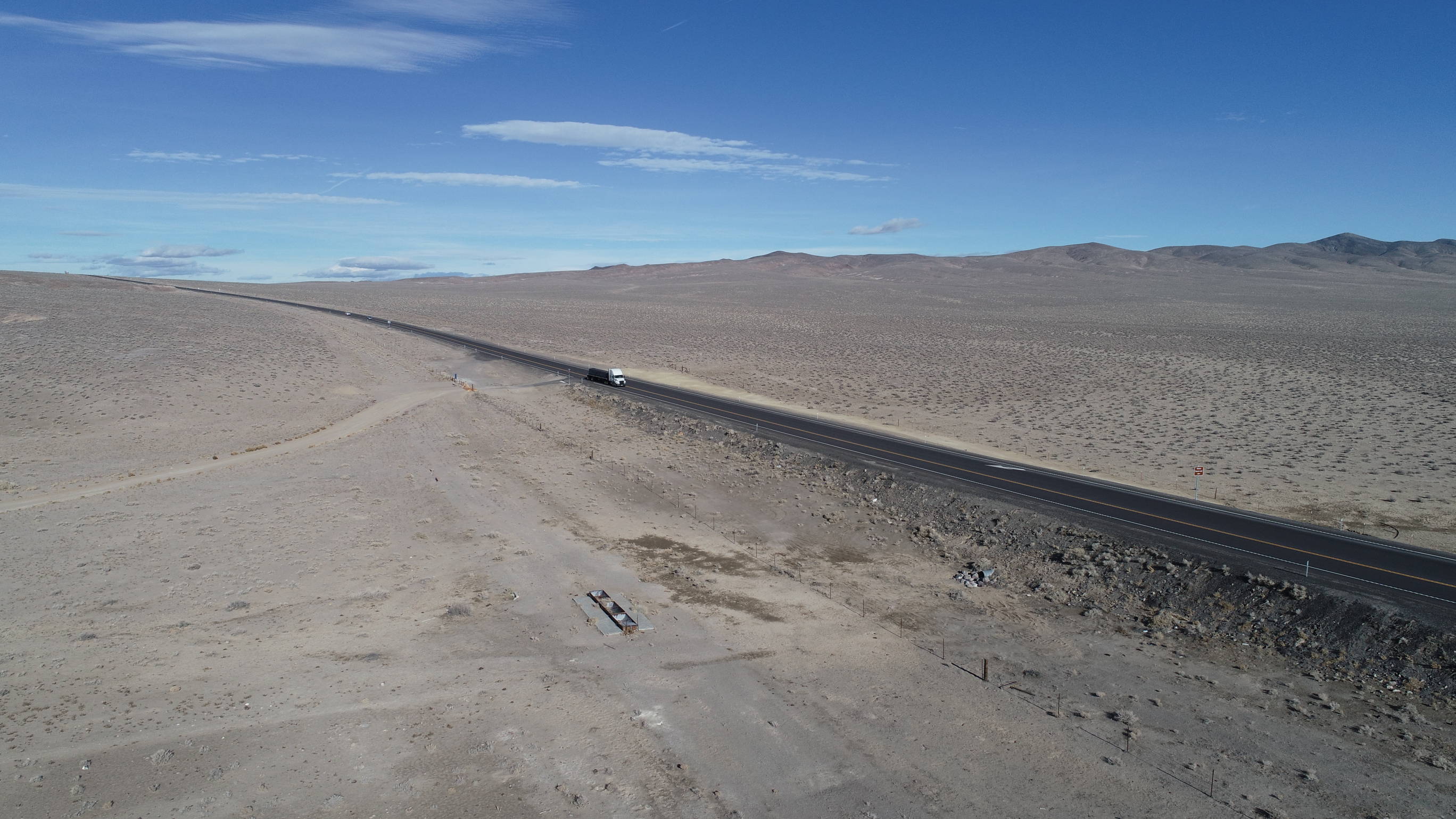
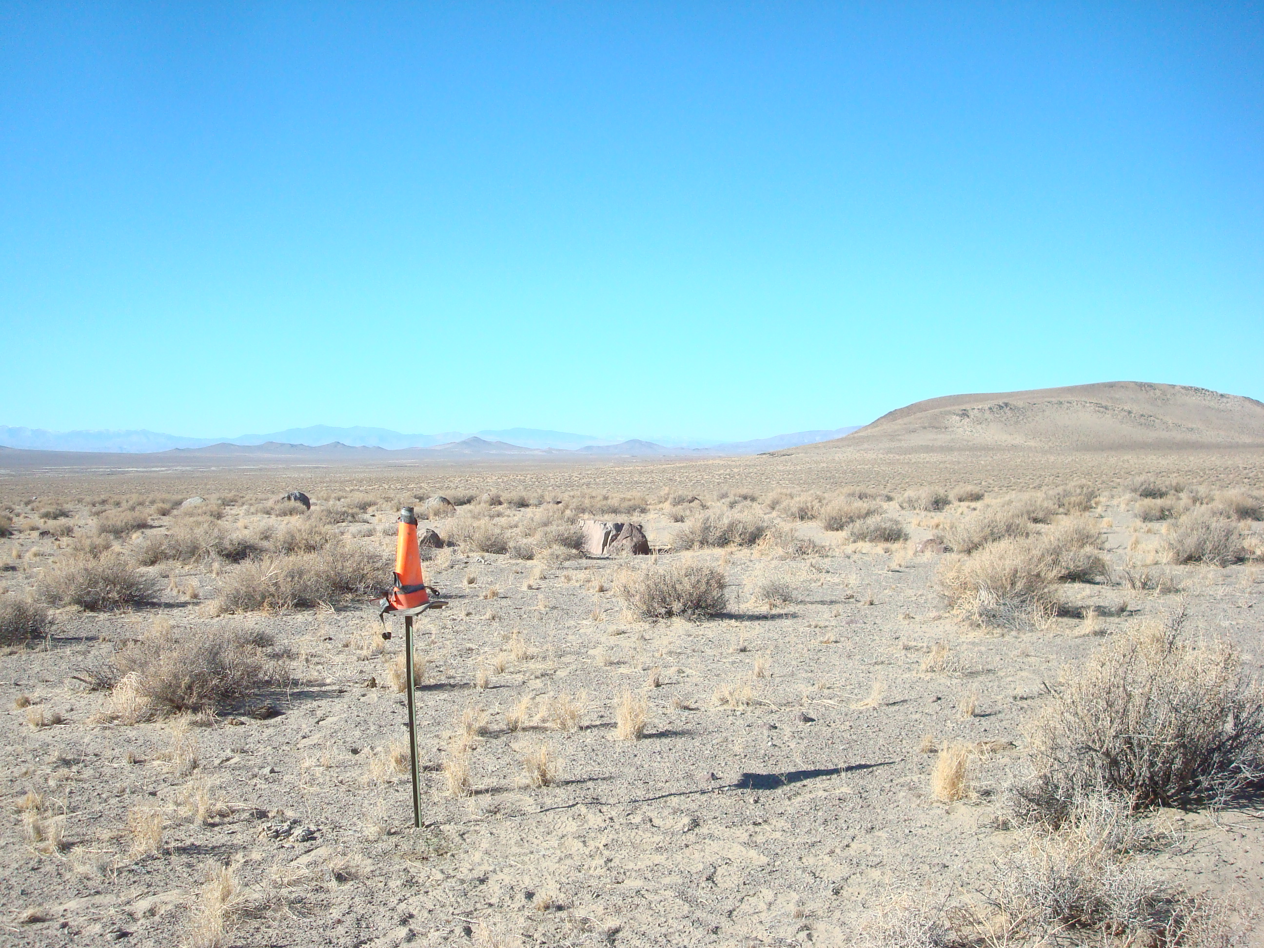
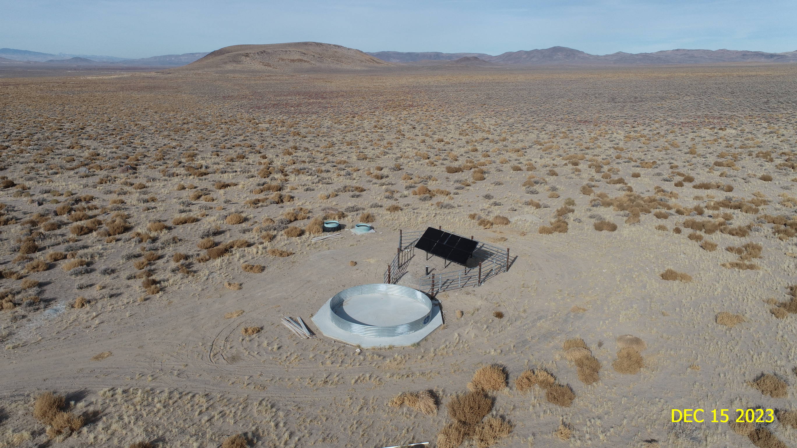
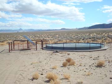
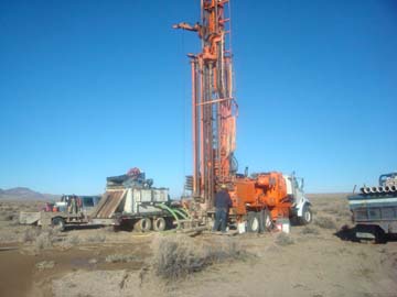
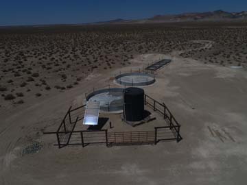
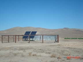
95 Solar Well Project Photos below are before and after the new well was developed, solar generated power to the pump was installed, the new well is located by U.S. Hwy 95, about 5-miles north of the Schurz, NV community, this facility will serve 500-head of cattle in this grazing lot. This project was funded by EPA.
Before & After Construction Photos 2022 Rattlesnake
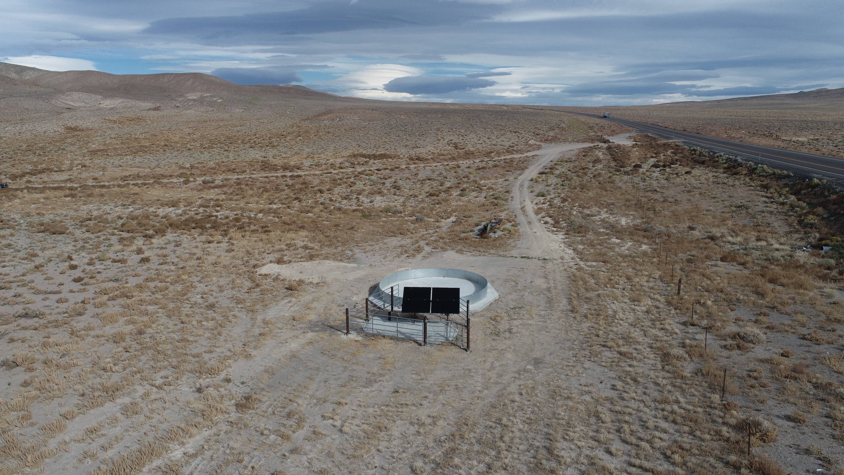
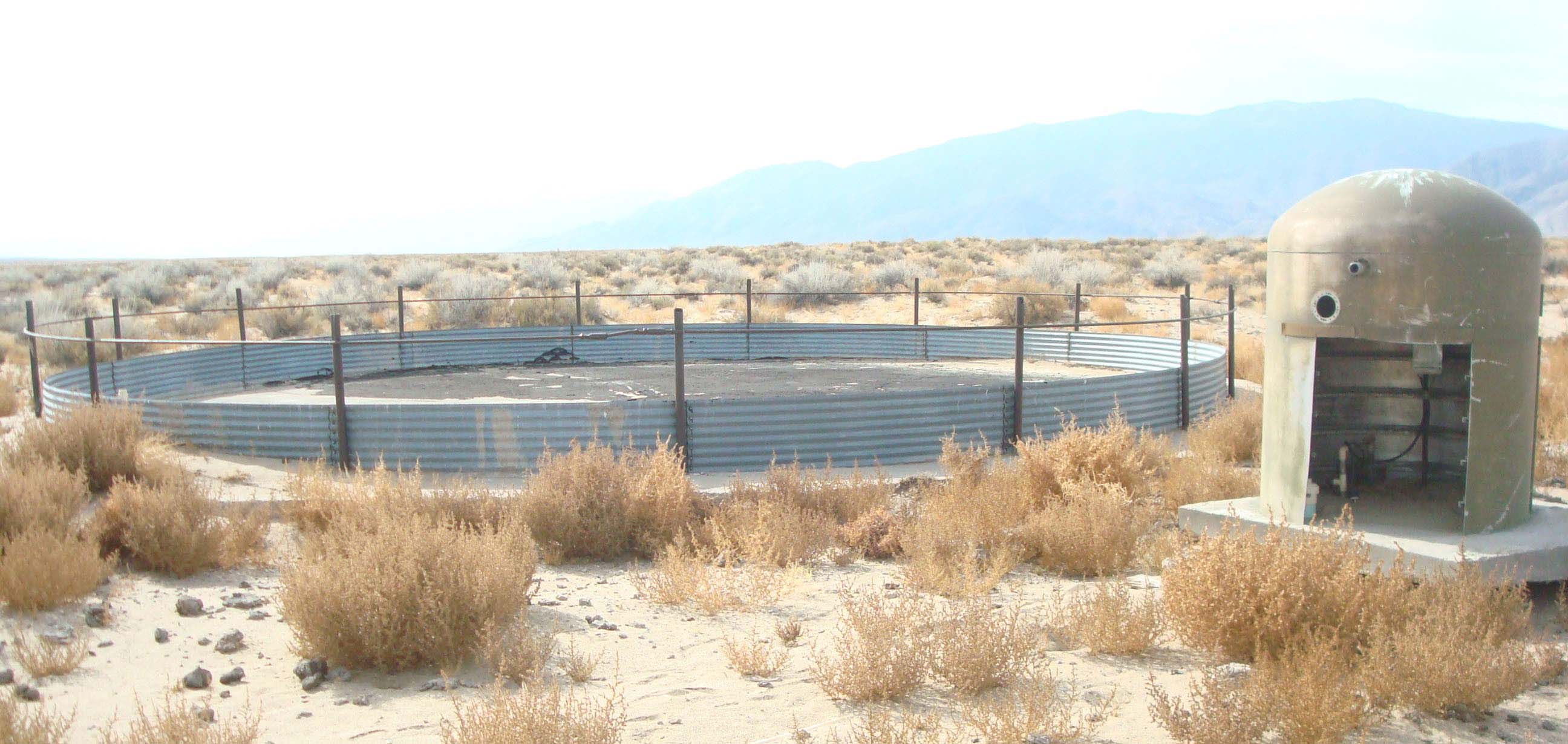
Solar Well Project Photos below are before and after the new well was developed, solar generated power to the pump was installed, the new well is located in the upper Walker River - close to the Weber Reservoir, about 5-miles northwest of the Schurz, NV community, this facility will serve 500-head of cattle in this grazing lot. This project was funded by EPA.
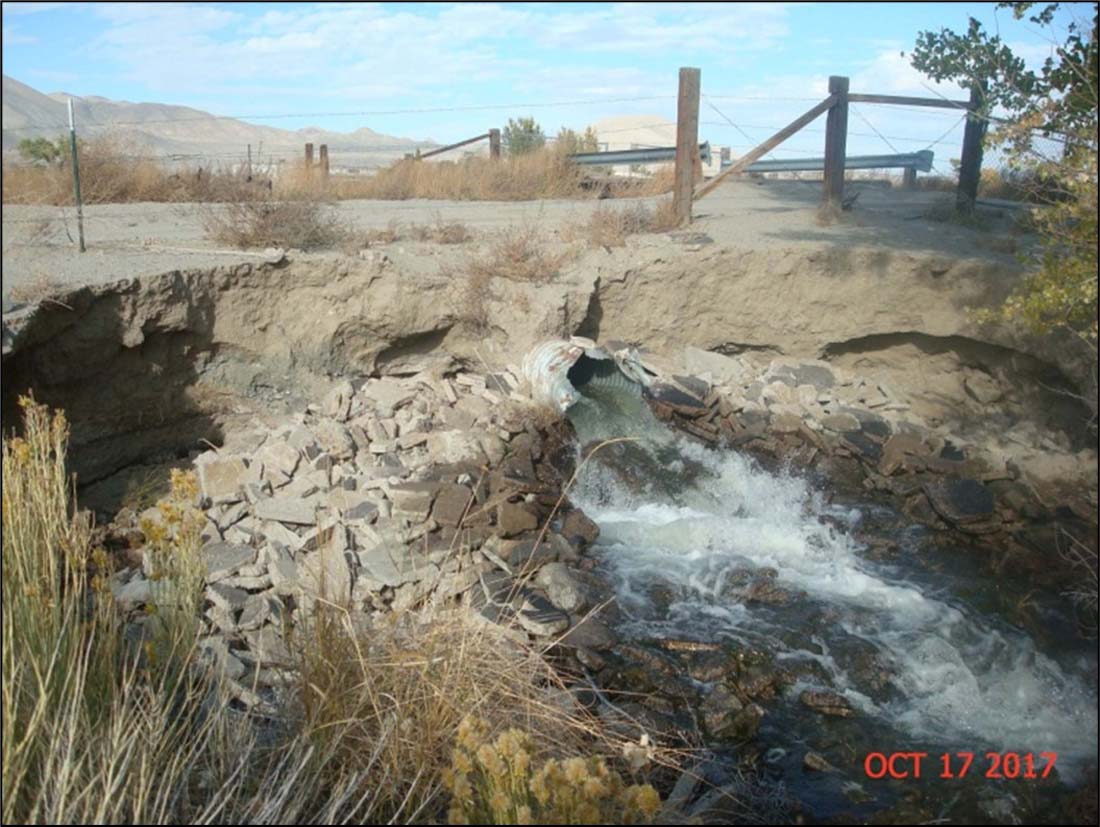
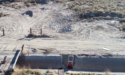
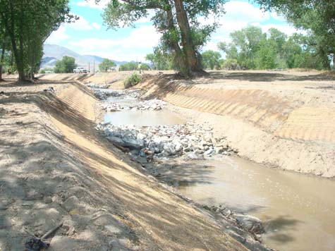
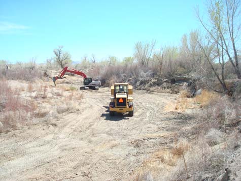
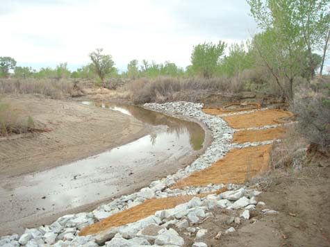
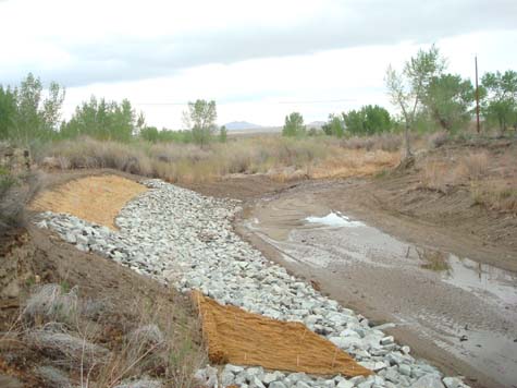
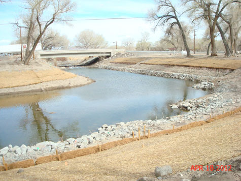
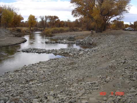
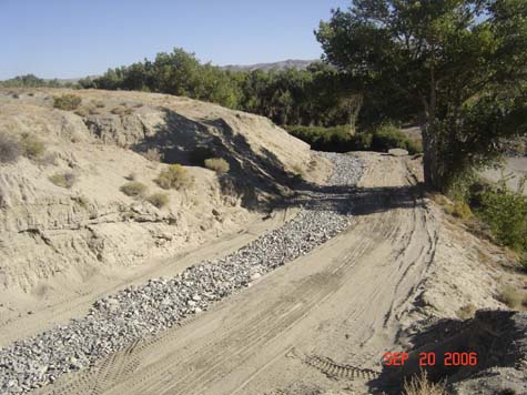
Before & After Construction Photos 2020 Irrigation Return Flow #2 Project Photos below are the before and after construction by Canal-1, this was a grant funding from EPA for reducing sediment loading into the Walker River, the project was delayed due to issues with landowner consent & Army Corps of Engineers permitting. Project completed in October 2020
Before & After Construction Photos 2020 Hicks Well Solar Project Photos below are the before and after installation of the solar generated power for the Hicks Well, the well was previously run by diesel fuel generator. The well serves about 500-head of cattle when they are in this grazing lot.
Before & After Construction Photos 2020 Rawhide Well Solar Project Photos below are before and after the new well was developed, solar generated power to the pump was installed, this facility will serve 500-head of cattle in this grazing lot. This project was funded by the USDA NRCS-EQIP from our local offices in Nevada.
Before & After Construction Photos
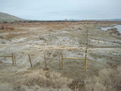
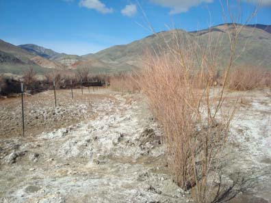
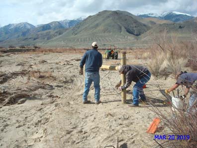
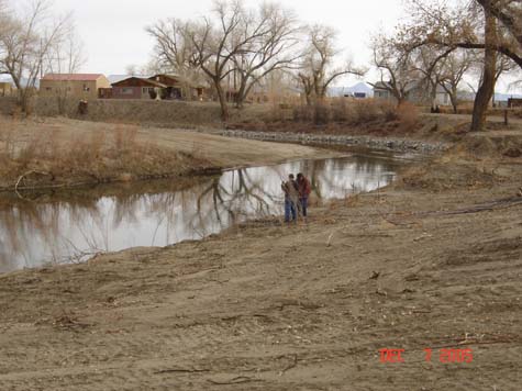
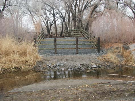
2019 Oxbow Meander Riparian Project at WR-10 Photos below are taken at one of the Tribe's water quality sampling sites on the Walker River, the crew planted willows & installed fencing, the objective is to find out if willows can be re-established in this area with salt cedar as the predominant plant species. This pilot project site is located on the lower Walker River close to Walker Lake. As Built Design - Click to View
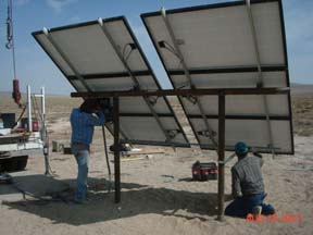
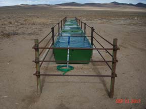
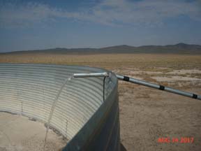
2017 Buckskin Well Solar Project This site is at the Buckskin Well, which is located on the north end of the Reservation for grazing cattle & wildlife, the Tribe received funding from NRCS-EQIP and workforce from the Tribal Cattlemen's Association to make all this happen, a big thanks to them for a successful project. For 2018 year we are putting in another grant request with NRCS-EQIP Program to run a pipeline from the green livestock troughs (photo below)to a mile long stretch to another set of new troughs to serve another section of grazing lot, the project plans are pre-completed; this will be phase 2 of this project.
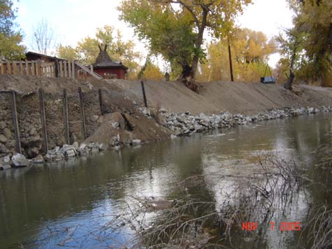
Before & After Construction Photos 2015/2016 Irrigation Return Flow Ditch Project
Before & After Construction Photos 2013/2014 SITE-6 Project
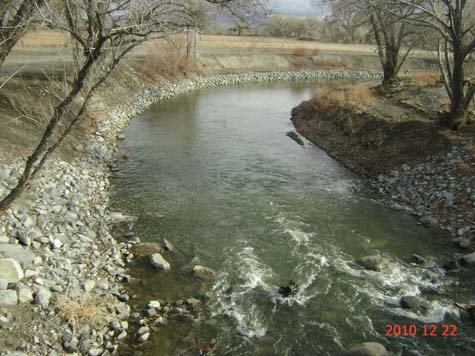
Before & After Construction Photos 2010/2011 ER-34 "PARK" PROJECT
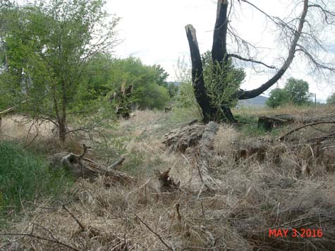
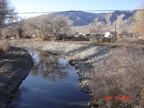
This site was restored to stablize an eroding bank, thus preventing sediment loading into the river - a nonpoint souce pollution prevention practice Before & After Construction Photos 2004/2005 ER-37 Project
Before & After Construction Photos 2004/2005 Harvey #1 & Gully #1 Project
Before & After Construction Photos 2005/2006 House #1 Project
Before & After Construction Photos 2005/2006 Flumes Ditch Project
Before & After Construction Photos 2007/2008 ER-33 Project
Before & After Construction Photos 2007/2008 ER-38, ER-38-2, ER-38-3 Project
Before & After Construction Photos 2006/2007 Corral #1 Project
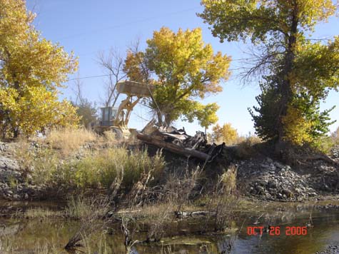
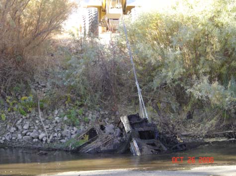
Before & After Construction Photos 2004/2005 River Clean-Up Project
Before & After Junk Car Removal Photos
|

|
To e-mail us regarding
this website - |